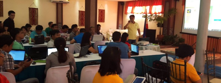
 RPCO-CAR Rural Infrastructure Engineer Ayson Romano discusses basic procedures on geotagging during a training in Tabuk City, Kalinga.
 RPCO-CAR capacitates Kalinga partners thru geotag training
Geotagging has found its mark as a monitoring and evaluation tool in the implementation of rural development projects in the Cordillera.
Its application in the project implementation makes it the most appropriate strategy for transparency, allowing every concerned party to view and monitor the progress and impact of a project.
Dr. Danilo P. Daguio, Regional Project Coordination Office-CAR (RPCO-CAR) Deputy Project Director said that geotagging is a skill that the DA-CAR and its partners must possess, especially those tasked with the implementation of the Philippine Rural Development Project (PRDP).
“Expertise on geotagging is also seen to facilitate the preparation of feasibility studies and other documentary requirements needed in proposing subprojects,” he added.
In this regard, a two-day training on geotagging was undertaken in Tabuk City, Kalinga initiated by the PRDP RPCO-CAR.
Around 40 personnel from the different Municipal and Provincial Local Government Units (MLGU/PLGU) of Kalinga participated in the training to enhance their capability on the practice and efficiency of geotagging.
Provincial Project Monitoring and Implementing Unit (PPMIU) Head Engr. Domingo Bakilan stressed the importance of the objective of PRDP on capacitating the LGU-partners with this expertise. He said that overlapping projects will be avoided through this technology.
Moreover, a hands-on geotagging exercise was conducted along the area of Bulanao, Tabuk City. The participants were able to familiarize themselves with the use of geotagging tools such as the PRDP Geo Camera, My tracks, and the GPS status. (Elvy S. Taquio, RPCO-CAR, InfoACE)
