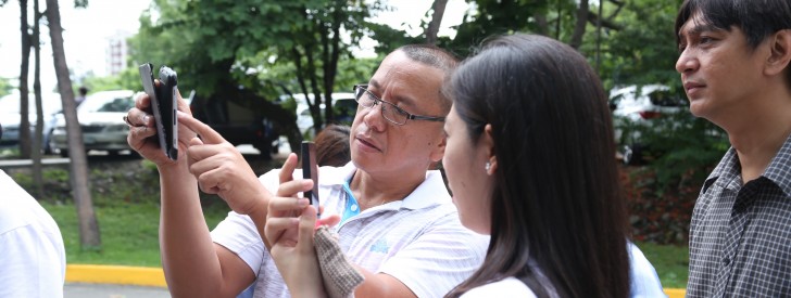
 Geotagging and Governance Unit Head Samuel Belamide (center) instructs participants on using GPS-enabled android cameras to geotag current location during the Geotagging 101 training for Civil Society Organizations on June 20, 2014 in Ateneo School of Government in Quezon City. (Photo by: Kathrino Resurreccion)
 DA-PRDP introduces geotagging for project monitoring to CSOs
June 27, 2014
Manila, Philippines–To inform and engage Civil Society Organizations (CSOs) with the transparency measures that the Department of Agriculture (DA) is pursuing through the Philippine Rural Development Program (PRDP), members of different CSOs were trained on Applied Geotagging on June 20, 2014 at the Ateneo School of Government (ASOG) in Quezon City.
PRDP Deputy Program Director Arnel de Mesa discussed the utilization of Geotagging in the implementation of PRDP, while Geotagging and Governance Unit Head Samuel Belamide trained the participants on the actual process of geotagging.
DPD de Mesa explained that geotagging was started in Mindanao under the DA-Mindanao Rural Development Program Phase 2 as a tool to verify and monitor infrastructure projects in far-flung and conflict areas in the region.
“There have been problems in validating conflict areas in the region, that even World Bank has limited exposure to such areas,” added de Mesa.
For PRDP, geotagging will be vital in promoting transparency in implementing sub-projects under the program, and will be integrated in the Program’s procurement system. Through Applied Geotagging, prospective bidders can have a virtual visit of the project site. Moreover, contractors need to be trained on the use of the innovation so they can geotag the progress of the sub-project they are engaged in.
De Mesa explained that geotagging is a requirement for contractors to get paid for their work. If their geotagged photos are not commensurate for their report on the sub-project development, then they will not be paid. Furthermore, geotagged photos of the sub-project will prove its existence.
De Mesa added that they want to promote the use of geotagging among CSOs as a transparency measure as well as involve them in making sure that the government projects actually exist.
During the training, Mr. Belamide assured participants that the PRDP only utilizes free software in geotagging and uploading images of PRDP projects online. He added that while farm-to-market roads are classic examples used in geotagging, any location-specific interventions can be geo-tagged.
The basic tools and applications needed for geotagging are: GPS-enabled camera on android phone or tablet, laptop or desktop, geotagging applications such as MyTracks and GPS Status, Google Earth, Picasa, and Google account.
He said that the PRDP has also developed a camera app that will protect the authenticity of photos geotagged under the PRDP.
World Bank Senior Procurement Specialist Noel Sta. Ines said that the training aims to familiarize the CSOs on basic geotagging which can help them appreciate the innovation and engage in monitoring the government’s programs and interventions.
He also encouraged CSOs to do their part in checking what the government is really doing in terms of project implementation such as PRDP.
“While geotagging is not yet widely used by other government agencies, we want DA to serve as benchmark and influence other line agencies through the PRDP on the use of geotagging in validating and verifying interventions of the government,” added Sta. Ines.
The event is co-organized by the World Bank and Affiliated Network for Social Accountability in East Asia (ANSA-EAP).
CSO members from Boy Scout of the Philippines (BSP), Partnership of Philippines Support Service Agencies (PHILSSA), National Citizens’ Movement for Free Elections (NAMFREL), National Conference of Small Farmers and Fishers (PAKISAMA), Catholics for RH, Arellano University, Philippine Institute of Civil Engineers, and ASOG attended the said training. (Cath Nanta, PRDP-NPCO)