DA-PRDP advances government-led projects’ reforms using innovative tools
Is the right activity implemented in the right place? That is a major question being asked by the Philippine Rural Development Project’s (PRDP) management as part of its mission to lead reforms in implementing government projects. This is made easier using science-based tools developed by the Project’s Geomapping and Governance Unit (GGU).
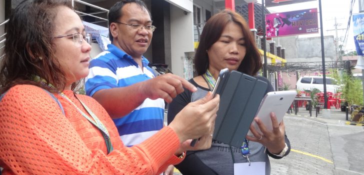
GGU continues to train more project partners and staff in using science-based tools such as Applied Geotagging Technology (AGT) and Expanded Vulnerability and Suitability Assessment (E-VSA). About 50 participants from municipal and provincial local government units and proponent groups in South Luzon attended the training on the use of AGT and E-VSA held in Albay on October 17-21, 2016. Joseph Pacon, Alternate GGU Head of the National Project Coordination Office (NPCO), coached the participants on the application of E-VSA, digital cartography using Quantum Geographic Information System (GIS), and data management or processing of geotagging photos.
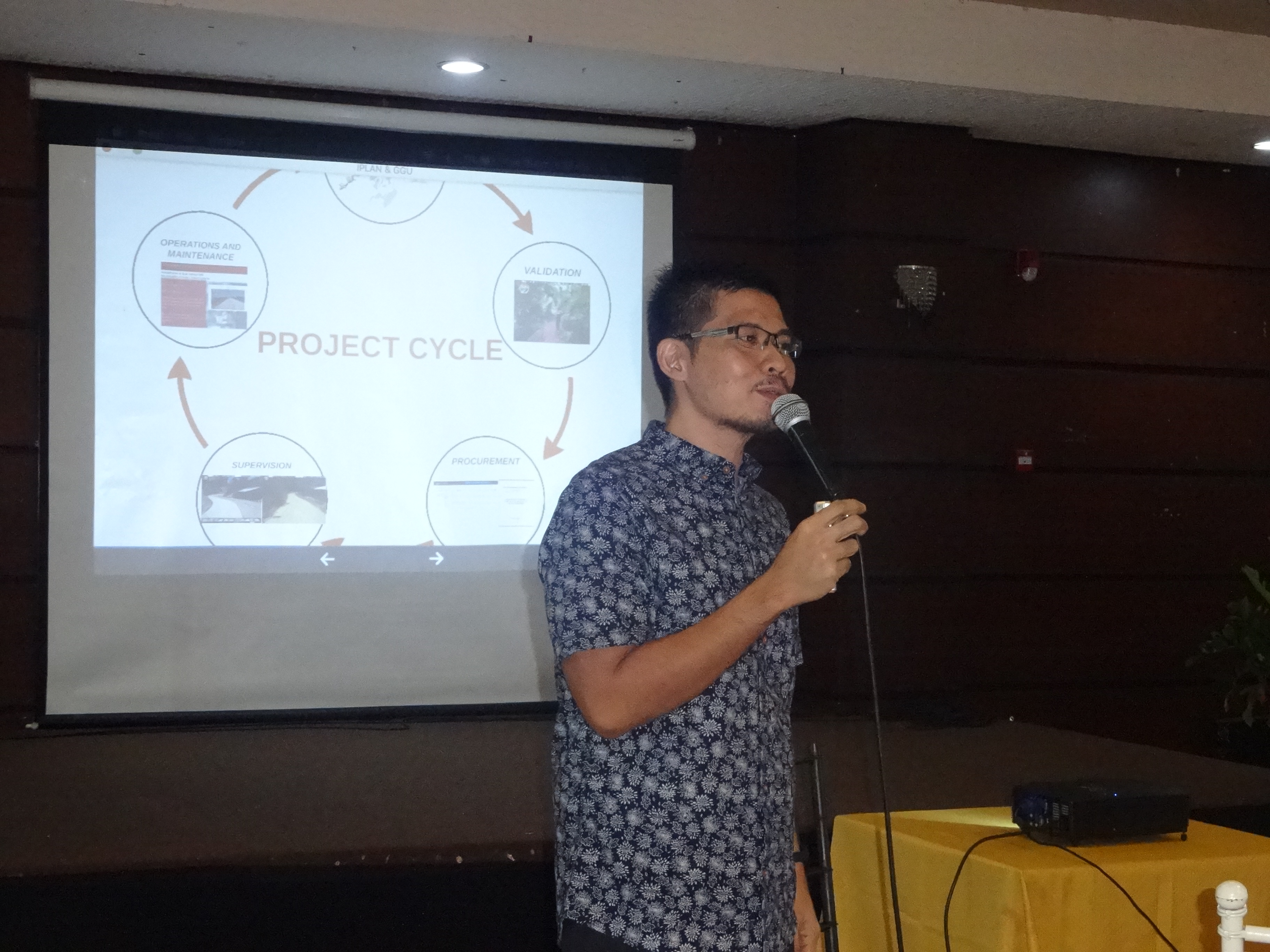
Joseph Pacon, Alternate Geomapping and Unit Head of the National Project Coordination Office, discusses the integration of GGU in all stages of the Project’s cycle. (Photo by Annielyn L. Baleza, DA-PRDP RPCO V InfoACE Unit)
According to Pacon, PRDP’s tools are geared towards ensuring transparency in governance.
“Yung pinagkaiba natin sa ibang projects is meron tayong tools na ginagamit called science-based tools which are based on studies nung mga data na ginamit natin and we incorporate these with tools na makakapag-determine kung saan needed yung mga investments under the PRDP. Hindi lang basta-basta maglalagay tayo ng roads o projects, they should always show to us kung ano yung value added doon,” Pacon said.
Pacon mentioned that DA-PRDP is first to implement the integration of AGT into a government-led project’s supervision and monitoring requirement. He added that GGU cuts across all the Project’s components.
“We are independent as a unit but we are inter-dependent in the entire project,” he said. He added that GGU is integrated in all stages of the project cycle from planning, validation, procurement, supervision and operations and maintenance. Using these tools, Pacon stated that the Project has saved over P700 million from canceled and redesigned overlapping sub-projects, validation of overbloated figures cited in the feasibility studies, and construction of sub-projects parallel to national roads. Around P1.2 billion-worth of sub-projects for No Objection Letter issuance were deferred until justified by the proponents.
Moreover, Pacon noted that using PRDP’s science-based tools opened doors of opportunies for trained LGUs and cooperatives to partner with other agencies. He added that some LGUs have also adopted PRDP’s innovative tools to their regular programs by using mapping-based system and data for better planning and decision making.
John Isuela, Integrated Pineapple Processing Project Coordinator of Labo Progressive Multi-Purpose Cooperative (LPMPC), works on a mapping exercise during the training on the use of AGT and E-VSA held in Albay on October 17-21, 2016. (Photo by Annielyn L. Baleza, DA-PRDP RPCO V InfoACE Unit)
John Isuela, Integrated Pineapple Processing Project Coordinator of Labo Progressive Multi-Purpose Cooperative (LPMPC) and one of the participants during the said training, shared his excitement to produce a map of LPMPC’s pineapple plantation and poverty incidence among its farmer-members. He added that using geotagged photos, the cooperative can upgrade its system of reporting and upload them to other partner agencies.
“Maganda gamitin ang tool at mapapakinabangan namin sa pagmo-monitor ng cooperative,” he said.
The DA-PRDP GGU team plans to establish and strengthen its GIS-based data to create one base map with geotagged photos which will be accessible online as a tool for planning, monitoring, supervision and public disclosure. Furthermore, GGU will soon utilize unmanned aerial vehicle technology for aerial geotagging requirements.
AGT is a sub-project management tool that enables stakeholders to virtually see and validate proposed and on-going sub-projects using free and available application and online services. Meanwhile, E-VSA is a user online tool being used in crafting the Value Chain Analysis (VCA) and Provincial Commodity Investment Plan (PCIP), that shows the ranking of prioritized municipalities based on socio and economic parameters.
DA-PRDP is a six-year nationwide project aimed at increasing farmers’ income and establishing an inclusive, market-oriented and climate-smart agri-fishery sector in targeted project areas. (Annielyn L. Baleza, DA-PRDP RPCO V InfoACE Unit)