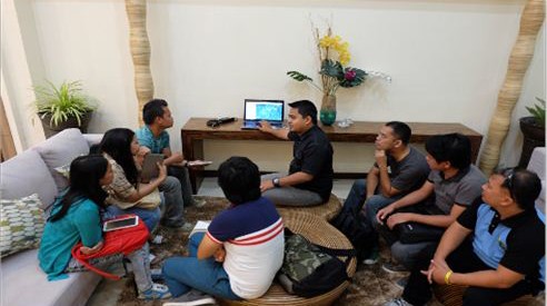
 Carlo Willisfer Jontilla, Project Support Office – Visayas Cluster Geomapping and Governance Unit Head conducts a crash course on Geotagging for contractors and bidders of Loboc farm-to-market road.
 Central Visayas trains on Applied Geotagging

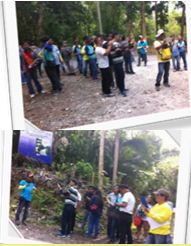
44 participants underwent an Actual Field Application of Applied Geotagging in Loboc farm-to-market on March 1-2,2016.
To promote transparency in the implementation of projects under the Philippine Rural Development Project (PRDP), geotagging is required. Geotagging is a scientific tool that refers to the process of associating a digital resource with a physical location.
Through this tool, the Regional Project Coordination Office 7 (RPCO7) conducted a two-day hands on-training on applied geotagging tool for the Municipal and Provincial project Monitoring Implementation Unit (M/PPMIU) to help equip the project implementers on the importance and application of geotagging in all projects under PRDP as well as packaging of data and information into a single file for the submission of reports. Actual geotagging application was held in the Alegria –Bugho farm-to-market road (FMR)
Geotagging is an inexpensive approach in the validation, monitoring, and evaluation of projects especially during the pre-construction, construction, and completion phase. Through this process, a person can have a virtual visit of the projects, provide view on the entirety of its physical progress and influence area or simply seeing a more accurate visualization of the project.
This will eliminate duplication or overlapping of infrastructure projects from other government agencies because of the global positioning system (GPS) data.
Meanwhile, Carlo Willisfer Jontilla, Geographic Information System Officer of PSO Visayas, conducted a crash course on Geotagging to the contractors of the Loboc FMR with emphasis on the use of geotagging not only for FMR but also on machineries and other I-REAP subprojects. (Bexmae P. Jumao-as, PDA, InfoACE – RPCO 7)
