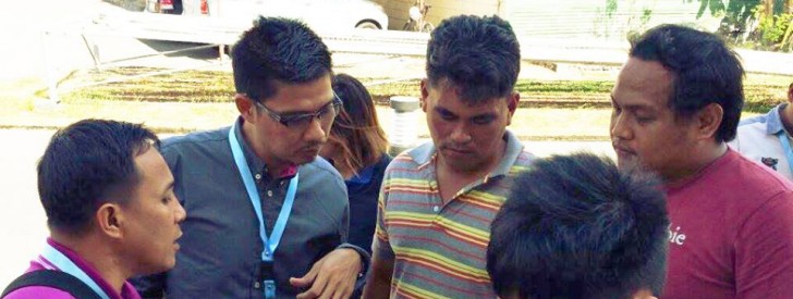
 GIS Data Specialist Joseph Pacon facilitates the training for applied Geotagging in Subic, Zambales
 Region 1 & 2 LGUs attend e-VSA and AGT training
Subic, Zambales – Aiming to further capacitate all partner Local Government Units (LGUs) with the use of integral tools and skills, a four-day training on the utilization of the Applied Geotagging Technology (AGT) and Expanded Vulnerability and Suitability Assessment (E-VSA) was conducted in this city. In participation were the LGUs of Region 1 and 2, facilitated by the National Project Coordination Office (NPCO), Project Support Office (PSO) Luzon A and Regional Project Coordination Offices (RPCOs) last April 6-9 in the Mansion Garden Hotel.
Through the use of the software QGIS, Geographic Information System (GIS) Specialist Arnel Tenorio led the workshop and lecture on e-VSA and GIS. GIS is a computer-based system tool for handling geographical data that is highly helpful in surveying, spatial analysis, temperature and more. “This system is essential for decision making and communication. It also serves as a tool for effective local governance,” said Tenorio.
The E-VSA on the other hand is an online tool accessible through the PRDP website, takes account of both agro-climatic data and socio-economic as basis in targeting interventions and formulating strategies for investments.
Another integral tool widely used in the Philippine Rural Development Project (PRDP) is the Geotagging. It is a Google Earth-based tool that promotes transparency and efficiency through virtual monitoring and supervision of project implementation.
Spearheaded by GIS Data Specialist Joseph Pacon, participating LGUs were given various exercises on the process of geotagging photos including hands-on activities on the field in various spots in Subic.
The Geomapping and Governance Unit (GGU) under the I-SUPPORT component plays a vital role in setting up the platform towards greater transparency and accountability in implementing PRDP subprojects. Utilizing high technology through the latest ICT innovations provide both implementers and the public easier access to these projects. (Kayla Arceo)
