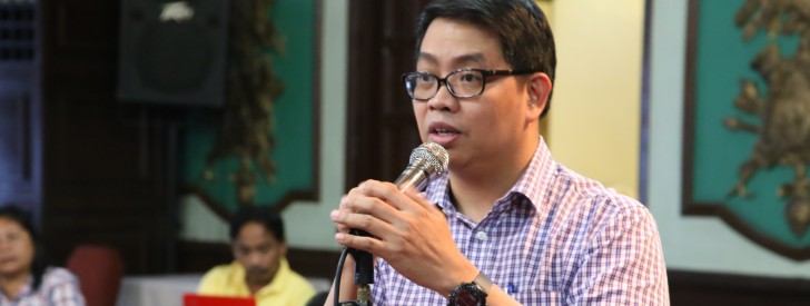
 PRDP Deputy Program Director Arnel V. de Mesa is keen about the innovations of the Geo-tagging tool developed under the MRDP 2 used to monitor and track project developments in far-flung and conflict-affected areas. Geo-tagging, which is internationally recognized by the World Bank as an efficient tool for transparency and good governance is now also being utilized under PRDP. (Photo by: Kathrino Resurreccion)
 DPD De Mesa shares Geo-tagging innovations at GEF IW: LEARN workshop
April 28, 2014 Manila—Philippine Rural Development Program (PRDP) Deputy Program Director Arnel de Mesa recently shared information and ideas on innovations of Geo-tagging tool in a workshop organized by Global Environment Facility International Waters Learning Exchange & Resource Network (GEF IW:LEARN) on March 17-20, 2014 at the Knowledge Hub of the Asian Development Bank (ADB) Headquarters in Manila.
Talking to over 20 representatives from various GEF international waters project and partner organizations, mainly from Asia and the Pacific, de Mesa presented the utilization of open source web-based geospatial tools as an innovative tool for enhancing transparency and project implementation and monitoring in an in-house developed, Geo-tagging tool.
De Mesa said that the Geo-tagging tool which was developed and utilized under the Mindanao Rural Development Program 2 (MRDP2) helped the government and the World Bank track progress of projects implemented in conflict-affected areas and remote sites.
Presently, Geo-tagging is also being utilized under the Department of Agriculture’s PDRP—a nationwide upscale version of the Mindanao Rural Development Program—to document various project sites by taking before, during and after photos of project implementation that include bridges, farm-to-market roads, irrigation systems, livelihood and marine sanctuaries.
Because of its innovative contribution in project implementation and monitoring under the MRDP2, Geo-tagging has been recognized internationally by the World Bank.
According to de Mesa, Geo-tagging involves attaching location-specific digital resources such as photos and videos, using a GPS-enabled phone or tablet and internet connection to upload multimedia in Google Earth.
The four-day workshop aims to provide a venue for experience and skills sharing, lectures and practical exercises, and collective action planning on geospatial data management, collaboration and publishing with the aid of open source tools. It is the first full workshop on spatial data management organized by GEF IW: LEARN in partnership with the ADB and the World Bank.
Ref: http://iwlearn.net/news/fostering-a-culture-of-data-appreciation-at-the-manila-iw-learn-ict-workshop